Prehistoric Flint Tools in Breckland
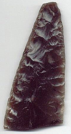
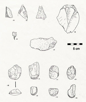
During the early 20th century, the Brecks were a favourite hunting ground for the collectors of prehistoric flint tools, who promoted the district as one of the richest sources of Stone Age artefacts in Eastern England. The Grime's Graves Late Neolithic and Bronze Age flint mine complex is central to the area, and the abundance of high-quality knapping flint must have had a significant impact on local flint-working practices. However, a new generation of archaeologists challenged this assumption during the early 1980s, using environmental evidence from excavations. They claimed that rather than a centre of late prehistoric activity, settlement was sparse and riverine in pattern — with most of the lithic finds dating to the Late Neolithic and Bronze Ages (3,500 to 600 BCE).
One of the aims of the Thetford Forest Project is to map out the densities, characteristics, and locations of flint flake scatters and prehistoric finds, to test the suggestion that the lithic finds are concentrated in the river valleys.
Lithics – An Introduction
Flint forms into layers of nodules in chalk beds. It is an excellent raw material for tool production — it can be fractured in a controlled manner to produce very sharp edges. A knapper will select a nodule, prepare it by striking off odd ends to make flat surfaces, or striking platforms, then start to strike flakes off the edge of this core. When struck with a hammerstone, flint fractures conchoidally. The energy dissipates away from the point of impact, forming a conchoidal bulb on the ventral (inside) face of the new flake. This bulb, sometimes with other signs such as ripples, a bulbar scar, and fissures, distinguishes the flake as human-made rather than natural.
The Survey
Information added to the project database includes the lithic density of each survey, the percentage of utilisation/retouch and hinge fractures, the numbers of waste cores, scrapers, etc. Densities are calculated by dividing the number of finds by the area of exposed surface searched, then projecting that onto an area — a ten-metre by ten-metre square. Subsequently, densities can be weighed between surveys.
Struck Flint Densities and Water Source
Recent sources have suggested that Late Neolithic settlement in Breckland was riverine in nature, and that flint finds increase with proximity to the rivers and meres. So far, I have found only a slight increase of average lithic densities close to rivers. All that I can state with certainty is that the density of struck flints is higher on average within 3.2 kilometres of a known water source than it is further away from water.
Struck Flint Densities and Soil-Type
The most obvious result so far is that lithic densities are usually very low, or even non-existent, on the surfaces of podzolised soils. These soils occur on the upland brown earths. Waste cores may be most common on gravel terrace soils.
Flake Utilisation
Another factor worth noting is the variation in the percentage of flakes with signs of retouch or utilisation. Could this data be used to suggest areas of land-use? Perhaps the areas with low rates of retouch were sources of raw material, while areas with lots of retouch and used flakes suggest areas where people used the flakes — cultivation, gathering, or habitation.
Although it is too early for conclusions, analysis of the finds suggests that many of the Breckland flake scatters are probably of late prehistoric date. High percentages of flakes carry hinge fractures and cortex, suggesting a low standard of flint workmanship, and broad squat forms usually dominate. I would suggest that most lithics were deposited onto the surfaces of the Brecks between 2,900 BCE and 100 BCE. However, many of the forest-walks also produced smaller numbers of heavily patinated flakes that are often slim and more blade-like, suggesting an earlier exploitation of the district, perhaps during the Later Mesolithic or Earlier Neolithic.
Burnt Flint (Pot-Boiler) Densities
I am also examining the distributions and densities of so-called pot-boilers — smallish burnt flints, usually whitened and crackled by intense heat. A number of archaeological origins have been suggested for these burnt flints — from heated stones used for cooking food to the waste product of prehistoric saunas. So far, I have failed to find any relationship between burnt and struck flint densities. They appear to be most common on the upper slopes, where the river valleys meet the uplands.
The Grime's Graves Belt
Frances Healy suggested that a belt of high-density flint artefact scatters stretched through the parishes of Santon and Weeting, to the south and west of the Grime's Graves Flint Mine site. Surveys carried out so far in that area confirm the existence of such a belt of flakes — although not a consistent belt.