Thetford Forest Archaeological Survey
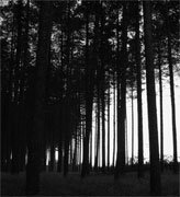
Thetford Forest is located in the East Anglian district of Breckland, south-east Britain, and is divided between the two English counties of Norfolk and Suffolk. Breckland is an area of light free-draining aeolian sandy soils, laying on a bed of cretaceous chalk, and has traditionally been used for heath, sheep pasture, rabbit warren and marginal arable farming. Thetford Forest is a modern lowland pine forest; created after 1919, it now covers 21,000 hectares of the Brecks.
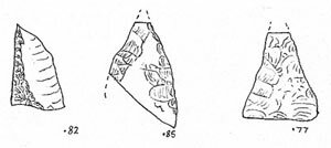
Aims of this landscape archaeology project included: 1) the enhancement of the sites & monuments record (a forerunner of the present-day HER) - detecting unrecorded archaeology sites; 2) the mapping of lithic (prehistoric struck flints) densities - examining the spread of prehistoric finds across Thetford Forest; 3) and the mapping of manure-scattered ceramics (light background scatters of small abraded sherds of pottery). I hoped to compare the accumulated archaeological data with landscape features. Fieldwalking methods were applied to a pine forest.
Why?
While aerial photographers, rescue archaeologists, metal detectorists, and field-walkers were gradually filling the records, forested areas appear as relatively blank areas - almost as though they did not have a past land-use. Local professionals in collaboration with the Forestry Commission were surveying Thetford Forest for earthworks. My work complemented this task. I applied the landscape archaeology technique of fieldwalking to exposed soils in the forest.
Recorded Achievements
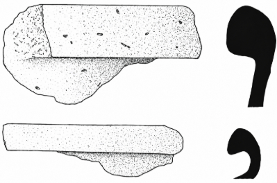
Several new sites were recorded between 1997 and 2006, including 1) a number of high density prehistoric flake and burnt flint scatters; 2) a three hectare late 4th / early 5th century Romano-British settlement; 3) an enigmatic 11th or 12th century Medieval industrial centre; and 4) several earthworks.
2026 Reflection - twenty years later
By 2026, the Suffolk and Norfolk Historic Environment Records (HER) confirm some of the above achievements were formally accredited. Yet, these records captured only the material yield—the small finds—and remain silent on the analytical architecture of the work. I now recognise that my approach was driven by a hyper-systemiser’s pattern-seeking mind; I designed the project’s methodology from first principles, employing an unconventional perspective that the curators at the time were ill-equipped to integrate or fully comprehend.
The Unrecorded Achievements
Information added to the project database included the lithic density of each survey, the percentage of utilisation/retouch and hinge fractures, the numbers of waste cores, scrapers, etc. Densities were calculated by dividing the number of finds by the area of exposed surface searched, then projecting that onto an are — a ten-metre by ten-metre square. Subsequently, densities were weighed between surveys. I believe that this methodology of surface collection was unique. This aspect is still absent from present-day HER records.
Struck Flint Densities and Water Source
Recent sources had pointed towards a riverine nature for Late Neolithic settlement in Breckland, and that flint finds increase with proximity to the rivers and meres. I found only a slight increase of average lithic densities close to rivers. All that I can state with certainty is that the density of struck flints is higher on average within 3.2 kilometres of a known water source than it is further away from water.
Struck Flint Densities and Soil-Type
The most obvious result was that lithic densities are usually very low, or even non-existent, on the surfaces of podzolised soils. These soils occur on the upland brown earths. Waste cores may be most common on gravel terrace soils.
Flake Utilisation
Analysis of the finds suggested that many of the Breckland flake scatters were probably of late prehistoric date. High percentages of flakes carry hinge fractures and cortex, suggesting a low standard of flint workmanship, and broad squat forms usually dominate.
The Grime's Graves Belt
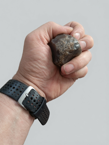
Frances Healy proposed that a belt of high-density flint artefact scatters stretched through the parishes of Santon and Weeting, to the south and west of the Grime's Graves Flint Mine site. Surveys carried out in that area confirmed the existence of such a belt of flakes. In 2019, I took a quick informal walk around a recently restocked area of Santon Road, Lynford at circa TL 818 882. I found dense lithic scsatters including rough waste cores, and many flint hammerstones. A spot close to the Little Ouse where flint rough outs may have been processed. I've seen this on other slopes in the Grimes Graves Belt. Usual grey to dark grey material.
Highest density of struck flint for any formal forest-walk in the entire project, was on the western edge of this belt at the Oteringhythe site in Weeting-with-Broomhill parish with a Very High Density of 18.1 struck flints per are (100 square metres).
The next highest density of 17.1 struck flint per are was found outside of the Grimes Graves Belt, some distance from the Little Ouse in Brandon Park at TL 779 837. Proximity to the Fen-edge and extinct waters may have been key to this site.
Burnt Flint (Pot-Boiler) Densities
I was also examining the distributions and densities of so-called pot-boilers — smallish burnt flints, usually whitened and crackled by intense heat. I have failed to find any relationship between burnt and struck flint densities. They appear to be most common on the upper slopes, where the river valleys meet the uplands. For example, Santon Downham at TL 823 838 (FW 31, Suffolk HER STN 065).
Romano-British Fields
Seven areas of the Forest produced Roman manure scattered ceramics. They occurred on a variety of soils. These included not only shallow slope soils, but in a number of cases, also on the deeper brownearths of the uplands. A particular area of interest was the Kings Forest area, where Roman manure scatter turned up on the uplands of West Stow and Wordwell in Suffolk.
The evidence is suggestive of a widespread cultivation of areas of the Brecks during the Romano-British period, with dated manure scatter turning up on some unlikely soils, normally reserved for heath. I suspect that the Romano-British era saw some significant forest clearances in the Brecks, possibly driven by high demand for fuel to feed kilns, forges, salting pans, and hypocausts?
Medieval Fields
Five areas of the Forest produced medieval manure-scatters. In each case, this occurred on the kind of landscape where past cultivation would be expected — on the shallower calcareous soils of the slopes, within the river valley zones. However, I would stress that soil type appeared to be more important than distance from water — medieval manure scatter has turned up on the farthest slopes from the modern rivers.
GPS and Non-Invasive Survey
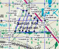
By Jan 2006 I was experimenting with the use of an EGNOS enabled handheld GPS for mapping out surveys. Not only to avoid the cumbersome use of a measuring wheel along the planting furrows, but with the addition of GarTrip software and an old-fashioned serial link, to map my surveys on Google Earth. See the attached image of this of 2006 amateur GPS mapping.
Additionally I was advocating a new survey method where I removed minimal finds from its location. Rather, I would record the numbers, characteristics and digitally photograph any interesting artefacts. The two techniques combined together, would permit a rapid yet still high quality and non-invasive survey of clear-felled compartments.
Perhaps the greatest unrecorded achievement of the project was its design. The methods and techniques employed to accumulate useful data across a landscape. An outsider approach to landscape history.
I would like to extend my thanks to Forestry Enterprise (East Anglia District), Suffolk Archaeology, Norfolk Landscape Archaeology, Colin Pendleton, Kate Sussams, Peter Robins, Edward Savory and everyone else who has past or present supported my project. But especially to Suffolk Archaeology.