Maps and Location
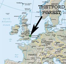
East Anglia is an English region of lowland south-east Britain, consisting of the counties of Norfolk and Suffolk, alongside parts of Cambridgeshire and Essex. Overall, the region is characterised as lowland – gently rolling to flat landscapes, predominantly rural and rich in arable agriculture. A stereotypical view of the region would be one of unspoilt villages separated by large fields of cereals and sugar beet, the landscape dotted by flint-faced medieval church towers.
However, within the region are a variety of districts with their own special characteristics. The Fens, for example, are one such district – a flat, low-lying area of peat-forming wetlands. Much of that district has been artificially drained to produce the rich black soils favoured by market gardeners.
The Brecks are another such East Anglian district – situated between the Fens to the west and the heavier clay soils of the East Anglian Plateau to the east. The Brecks are characterised by their dry, sandy soils that today support modern forestry, marginal arable farming, heathland, and USAF airfield bases.
The Brecks
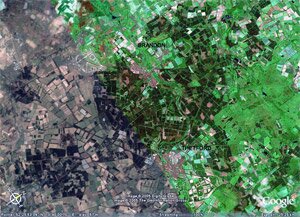
Thetford Forest is situated within a designated Environmentally Sensitive Area known as the Brecks or the Brecklands. The Brecks are spread across south-west Norfolk and parts of west Suffolk. Prior to the planting of the forest, much of the Brecks area consisted of heaths, sheepwalks, and rabbit warrens. Many of the excessively drained sandy soils were unable to sustain arable farming during times of low corn prices. It was an area that suffered serious sand-blows during dry summers, as light soils blew across the area, covering villages, damaging river navigation, and forming dunes. To counteract this problem, farmers began to plant the belts of Scots pine trees between fields – a landscape feature that has become symbolic of the district.
W.G. Clarke, an amateur naturalist and archaeologist, idealised this landscape in his definitive book of the area – In Breckland Wilds, first published in 1925. However, landscape historians are now acutely aware that far from being an ancient, unchanged landscape, much of Clarke's Breckland – an empty landscape of heaths – was the result of agricultural decline during the preceding century. Afforestation, military training areas, and USAF airbases simply represent the most recent of those changes.
Thetford Forest
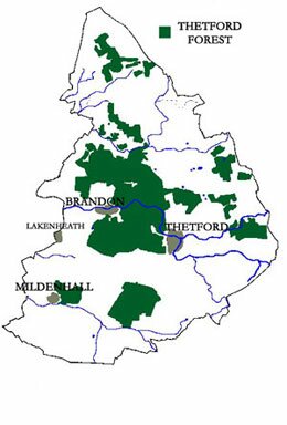
Thetford Forest is a 21,000-hectare pine forest that was planted in the Brecks area between the great wars of the 20th century. It was commissioned by a government concerned that during times of war, Britain did not have a sustainable timber supply. Consisting mainly of stands of Corsican pine, Thetford Forest is Britain's largest lowland pine forest. Public access to much of the forest is good, and in order to encourage public recreation, it has been designated as a Forest Park.