Aerial Photography
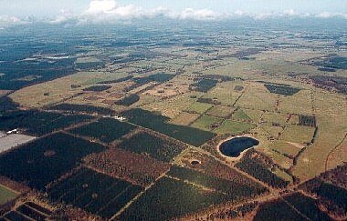
Edge of the Forest
This photograph taken of the edge of Thetford Forest at Wretham, demonstrates the importance of water in the Brecks. The ancient Drove trackway passes from left to right, between two meres on the uplands. The larger mere is Fowlmere, the small round mere below the Drove is called the Devil's Punchbowl. The Drove is believed to be a pre-Roman road, that led from the grazing lands of the Fen-edge across to the eastern edge of the Brecks.
The images on this page were kindly contributed by Mike Page of Skyview.
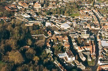
Thetford, Ancient Borough
Thetford was founded during the Late Saxon period, and was probably the fifth largest town in England and Wales by the 11th century. The right-hand side of this image shows the Norman market place, now infilled by mainly municipal buildings.
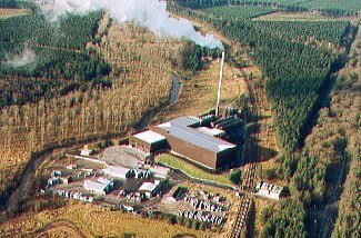
Industry in the Forest
Two Mile Bottom, Thetford, has been the site of industry for many years. Excavations carried out in 1998 revealed a number of Roman pottery kilns on the site. Today, it is the home of a brick yard, and of the fibrothetford biomass power station, that burns poultry litter to power its turbine. I worked there in operations for ten years. The industrial use of this site probably originates with its position along the Little Ouse River, and subsequently to river navigation.