September 1997 to November 1997
The Surface-Collection Survey (SCS) Programme 1997 August
All transects were spaced 40 metres apart, unless stated otherwise. Stints were always 20 metres long. Measurements were made either by tape or cyclometer. Soil-types and hence landscape facets were deducted from W. Corbett's soil map of Thetford Forest (Breckland Forest Soils 1973).
See full Methodology Page.
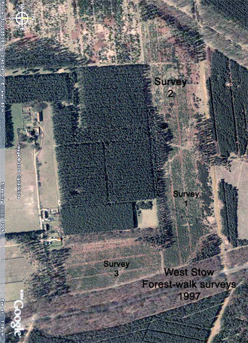
Forest-Walk 1
- Forestry Compartment: Kings 4036
- Suffolk SMR: WSW 045
- Parish: West Stow
- Date: 26-27/08/97
- Survey Area: 5.92 ha | Sample Fraction: 2.75%
- Centre on: TL 819 758
- Soil: Worlington upland brown earth, but some Worlington / Worlington shallow phase, stripy slope brown earths
- Relief: Flat, sloping only very gently facing west
- Water: 5 km to River Lark
Finds included:
- 2 sherds of probable Early Bronze Age pottery (and a further 2 such sherds on reconnaissance, including one with a fingernail impression).
- 2 sherds of Romano-British pottery.
- 2 flint convex scrapers.
- 2 retouched flint flakes.
- 8 unmodified flint flakes.
- 2 (poor quality) flint waste cores.
- 4 burnt flints.
- Background scatter of post-medieval and modern materials.
The presence of pre-Iron Age ceramics here must be considered significant, considering the soils and distance from known water source. Although the lithic density was low, several scrapers were recovered during the surveys on this area (forest walks 1, 2 and 3). The presence of apparent Roman manure scattered ceramics on forest-walks 1 and 2 is equally surprising and notable for this location.
Survey Metrics:
- Lithic sample size: 14
- Sample Area: 1,628 m²
- Lithic Density: Low (0.86 per are)
- Burnt flint density: 0.24 per are
Forest-Walk 2
- Forestry Compartment: Kings 4037
- Suffolk SMR: WSW Misc
- Parish: West Stow
- Date: 30-31/08/97, 4/09/97
- Survey Area: 5.36 ha | Sample Fraction: 2.75%
- Centre on: TL 814 757
- Soil: Worlington / Worlington shallow phase, stripy slope brown earths
- Relief: Gently facing south-east
- Water: 5 km to River Lark
A linear earthwork, probably a post-medieval field boundary, runs alongside the southern edge of the compartment.
Finds included:
- 1 sherd of ?prehistoric pottery.
- 5 sherds of Romano-British pottery (grey wares, colour-coated folded beaker and ?West Stow fineware).
- 1 small sub-square section of monumental oolitic limestone (probably post-medieval).
- 1 small flint bifacial flake knife.
- 5 flint convex scrapers.
- 5 retouched flint flakes.
- 20 unmodified flint flakes.
- 4 burnt flints.
- Background scatter of post-medieval or modern rubbish on east side of compartment, but not on western end.
Comments as for the previous forest-walk. The number of scrapers is unusually high.
Survey Metrics:
- Lithic Sample Size: 31
- Sample Area: 1,471 m²
- Lithic Density: Medium (2.1 per are)
- Burnt flint density: 0.27 per are
Forest-Walk 3
- Forestry Compartment: Kings 4042
- Suffolk SMR: WSW 046
- Parish: West Stow
- Date: 4/09/97
- Survey Area: 3.44 ha | Sample Fraction: 2.75%
- Centre on: TL 821 756
- Soil: Worlington, upland brown earth
- Relief: Flat
- Water: 5 km to River Lark
Finds included:
- 1 scrap-sherd of ?Bronze Age pottery.
- 1 flint convex end scraper.
- 4 unmodified flint flakes.
- No post-med or modern material seen.
Survey Metrics:
- Lithic Sample Size: 5
- Sample Area: 946 m²
- Lithic Density: Low (0.53 per are)
- Burnt flint density: Nil
Forest-Walk 4
- Forestry Compartment: Hockwold 6074
- Norfolk SMR: 33326
- Parish: Hockwold-cum-wilton
- Date: 22/11/97
- Survey Area: 2.56 ha | Sample Fraction: 2.75%
- Centre on: TL 754 904
- Soil: Methwold / Worlington complex. Semi-calcareous slope brown earths
- Relief: South-west facing
- Water: 3.4 km to Little Ouse
Finds included:
- 1 sherd of ?Romano-British pottery.
- 5 unmodified flint flakes.
- 3 burnt flints.
Slight background scatter of modern tiles and bricks noted.
Survey Metrics:
- Lithic Sample Size: 5
- Sample Area: 704 m²
- Lithic Density: Low (0.71 per are)
- Burnt flint density: 0.43 per are
Forest-Walk 5
- Forestry Compartment: Hockwold 6067
- Norfolk SMR: 33325
- Parish: Feltwell
- Date: 15/11/97
- Survey Area: 3.84 ha | Sample Fraction: 2.75%
- Centre on: TL 740 906
- Soil: Methwold / Worlington complex. Semi-calcareous slope brown earths
- Relief: Gradual south-facing slope
- Water: 3.4 km to Little Ouse
Finds included:
- 2 flint borers / piercers.
- 1 retouched flint flake.
- 7 unmodified flint flakes.
- 1 flint waste core.
- 1 burnt flint.
Survey Metrics:
- Lithic Sample Size: 11
- Sample Area: 1,056 m²
- Lithic Density: Low (1.04 per are)
- Burnt flint density: 0.09 per are
Forest-Walk 6
- Forestry Compartment: Hockwold 6077
- Norfolk SMR: 33324
- Parish: Feltwell
- Date: 15/11/97
- Survey Area: 3.2 ha | Sample Fraction: 2.75%
- Centre on: TL 745 906
- Soil: Freckenham / Redlodge complex, upland gravel brown earths and podzol soils
- Relief: South-west facing
- Water: 3.4 km to Little Ouse
Finds included:
- 1 flint knife/scraper combination.
- 2 unmodified flint flakes.
No post-med or modern materials noted.
Survey Metrics:
- Lithic Sample Size: 3
- Sample Area: 880 m²
- Lithic Density: Very Low (0.34 per are)
- Burnt flint density: Nil