December 1998 to January 1999
Forest-Walk 28: Downham 3041
- Norfolk SMR: 34278
- Parish: Santon Downham (Suffolk) / Thetford (Norfolk)
- Date: 22/12/98 | Survey Area: 6.08 ha
- Sample Fraction: 2.75% | Centre on: TL 8281 8424
- Soil: Worlington upland brown earth
- Relief: NE facing slopes | Height OD: 25-35m
Finds included:
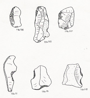
- 5 retouched/notched flint flakes.
- 54 unmodified flint flakes.
- 108 burnt flints.
Burnt flints are scattered at high density across the area, particularly in contexts G4, G5, H4, and H5 (TL 8284 8418). Forest-walk 31 later revealed an even higher density.
"Most flakes very sharp - absence of edge damage noticeable. Knapping skills and / or raw material quality much better than in many of these forest collections. Raw material almost exclusively weathered nodules with thick cortex."
Survey Metrics:
- Lithic Sample Size: 59
- Sample Area: 1,672 m²
- Lithic Density: 3.53 per are
- Burnt flint density: 6.46 per are
Forest-Walk 29: Hockwold 6103
- Norfolk SMR: 34277
- Parish: Hockwold-cum-Wilton
- Date: 17/01/99 | Survey Area: 3.84 ha
- Centre on: TL 7485 8824
- Relief: South-facing slope | Height OD: 10-20m
Finds included:
- 2 flint flakes.
- 1 burnt flint.
Despite being close to the fen-edge on chalky soils with previously recorded Neolithic finds, surface yield was very low.
Survey Metrics:
- Lithic Sample Size: 2
- Sample Area: 1,056 m²
- Lithic Density: 0.19 per are
- Burnt flint density: 0.09 per are
Forest-Walk 30: High Lodge 3064
- Suffolk SMR: BRD155
- Parish: Brandon
- Date: 29/01/99 | Survey Area: 3.2 ha
- Centre on: TL 8005 8423
- Relief: Dry valley slopes | Height OD: 35-40m
Finds included:
- 1 sherd Romano-British pottery.
- 1 convex scraper, 2 informal scrapers, 3 retouched flakes.
- 46 flint flakes, 1 keeled waste core (late prehistoric).
- 11 burnt flints.
Finds were stronger on the northern end (south-facing slope), where all three scrapers were recovered.
"Variation in patination suggests at least two assemblages / phases. Most pieces have amounts of cortex. Quality variable."
Survey Metrics:
- Lithic Sample Size: 53
- Sample Area: 1,040 m²
- Lithic Density: 5.1 per are
- Burnt flint density: 1.06 per are
Forest-Walk 31: Downham 3083
- Suffolk SMR: STN065
- Parish: Santon Downham
- Date: 29/01/99 | Survey Area: 3.76 ha
- Centre on: TL 8230 8377
- Relief: Flat | Height OD: 40-45m
Finds included:
- 1 sherd ?Romano-British pottery (micaceous).
- 5 retouched flakes, 41 flakes, 1 waste core.
- 154 burnt flints (sampled).
Burnt flints carpet the area, particularly at the southern end (contexts A1, A2, B2).
"Small presence of deeply patinated (mesolithic?) flints. Mainly unpatinated, relatively squat assemblage with large proportion with cortex. Fair quality workmanship - maybe end of EBA or MBA?"
Survey Metrics:
- Lithic Sample Size: 47
- Sample Area: 1,128 m²
- Lithic Density: 4.17 per are
- Burnt flint density: 13.65 per are